Natural Wonders That Sound Completely Made Up (But Aren't)
At some point in the past few centuries, reality stopped trying to be subtle. Perhaps it got bored. Perhaps the planet, having watched humans spend millennia building things and naming them impressive-sounding things, felt it needed to respond with something less apologetic. Whatever the cause, scattered across the world are places that have no business existing outside a computer-generated film sequence - and yet here they are, visitable, tangible, and utterly inexplicable.
This is a list of places that look completely fabricated and aren't. Each has a backstory as strange as the visuals, which is the part travel photography consistently fails to convey. The place looks like a screensaver. The reason it looks like a screensaver is considerably more interesting than the screensaver.
Fly Geyser, Nevada
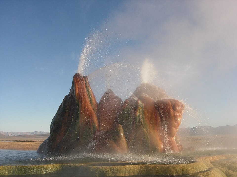
Fly Geyser is not a natural geyser. It is, if anything, the world's most successful accident. In 1964, a geothermal energy company drilled a test well on a remote Nevada ranch, hit a geothermal pocket, decided this particular spot wasn't commercially viable, and failed to properly cap the well. The pressurized water began erupting freely. Over the following decades, mineral deposits built up around the vent in vivid layers of red, green, and orange - the colors produced by thermophilic algae thriving in the superheated water.
The result is a three-metre mound on the Fly Ranch that looks like a prop from a science fiction production set in the 1970s, which is roughly when it achieved its current form. The colors aren't filters; they're living organisms growing in water hot enough to cause immediate burns. The plumes erupt continuously. The whole thing sat on private land in Washoe County and was, for most of its existence, visible only from the highway by people driving past and presumably concluding they were experiencing some kind of medical event.
The Burning Man organization purchased the land in 2016 and now offers guided tours. The decision to have the world's most visually spectacular accidentally-created geological feature managed by the organization responsible for the world's most elaborately intentional temporary art installation is either cosmically appropriate or deeply confusing. Possibly both. The geyser, for its part, continues erupting without apparent interest in the administrative arrangement.
Zhangye Danxia, China
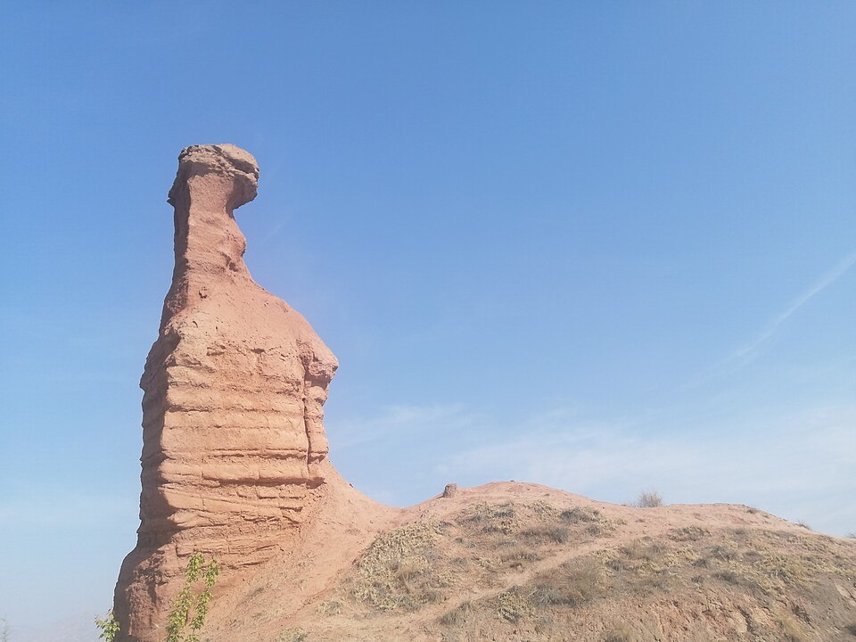
The Zhangye Danxia Geopark in Gansu Province, China, contains mountains that are striped in horizontal bands of red, orange, yellow, green, and grey, as though a geological process had decided that the conventional "grey rock" approach wasn't doing enough for the regional aesthetic. The effect looks like a color gradient applied to a landscape, which is the kind of visual arrangement you would accept in a fantasy novel illustration but would otherwise dismiss as impossible.
The coloration comes from millions of years of mineral deposits laid down in a sedimentary basin, subsequently compressed and tilted by tectonic uplift, then eroded by water and wind into layered formations. The reds are iron oxide - essentially rust at geological scale. The greens come from chlorite minerals. The yellows from sandstone weathering. The mountains have been forming for approximately 24 million years, which is a significant investment of time for something that primarily looks like it was made for a background image.
UNESCO listed the Danxia landscape formations as a World Heritage Site in 2010, bringing the geopark to wider international attention. Prior to that, it was known mainly within China, which - given what it looks like - suggests travel marketing has a coverage problem in Gansu. Chengdu makes a reasonable starting point for exploring this part of China, though Zhangye is the more direct access city for the geopark itself. The best light, as with most dramatically colored geological features, is early morning and late afternoon.
The Door to Hell, Turkmenistan
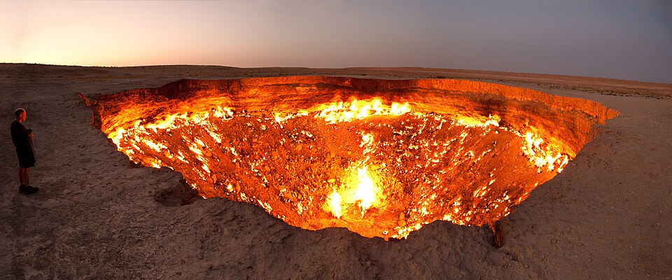
In 1971, Soviet geologists drilling for natural gas in the Karakum Desert hit an underground cavern, causing the ground to collapse and releasing a significant quantity of methane. To prevent the gas from spreading, they set the crater on fire, reasoning it would burn off within a few weeks. This was not what happened. The Darvaza gas crater has been burning continuously since 1971. It is approximately 69 meters wide and 30 meters deep. It glows. It is hot. The "few weeks" estimate was off by approximately fifty years and counting.
The Turkmen government officially named it "The Door to Hell" in 2013, which is the rare moment of government naming that requires absolutely no additional commentary. It sits in a stretch of Karakum Desert that has limited competing attractions, which means the primary reason to be in the vicinity is to see the crater, and the crater is very much worth being in the vicinity of. Standing at the edge at night - when the glow is most visible against the desert sky - is one of those travel experiences that is described adequately by photographs and experienced entirely differently in person.
A Turkmenistani government committee proposed filling the crater in 2022 on the grounds that it was damaging the environment and wasting extractable natural gas. As of this writing, it remains lit. The fire did not appear to consult the committee. Getting there requires either a multi-day organized tour from Ashgabat or independent navigation of a desert with minimal infrastructure, which places it firmly in the category of travel that rewards planning - and pairs well with reading our guide to genuinely remote places before booking.
Blood Falls, Antarctica
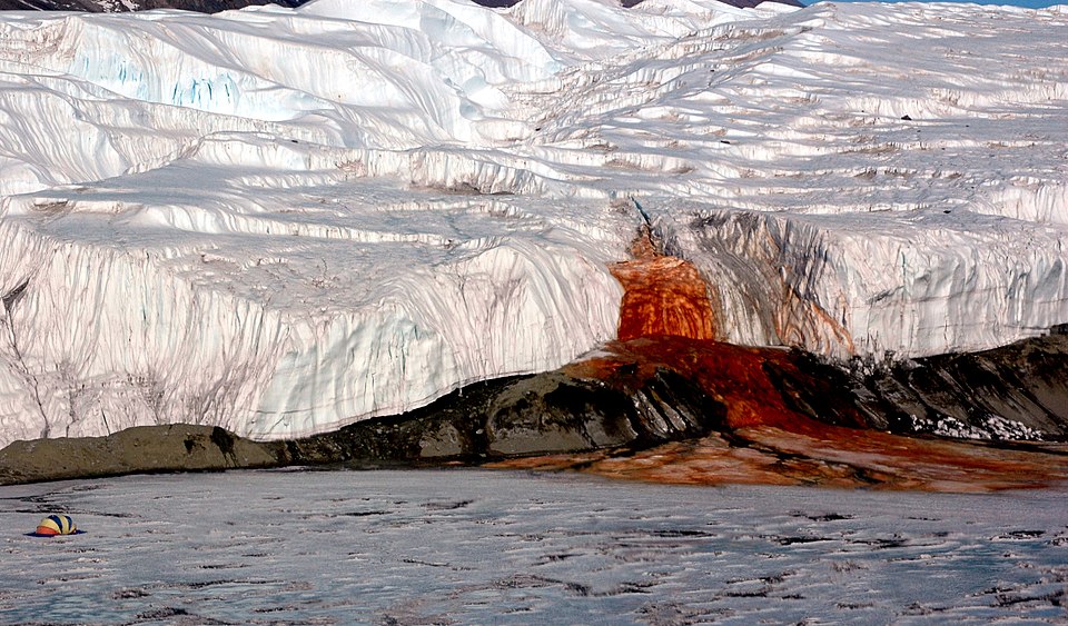
Blood Falls is a five-storey waterfall of dark red liquid seeping from the Taylor Glacier in Antarctica's McMurdo Dry Valleys. Discovered in 1911 by the geologist Griffith Taylor, who assumed it was caused by algae, it was later identified as something considerably more interesting: an ancient saltwater lake trapped beneath the glacier for approximately 1.5 million years, rich in dissolved iron, with no oxygen and a full microbial ecosystem that had been living in complete isolation since the Pliocene epoch.
When the iron-laden brine makes contact with surface air, it oxidizes - rusting, essentially, in real time. The blood-red color isn't dye or algae or any conventional biological pigment. It's liquid that has been sitting under a glacier since before modern humans existed, seeping out and turning red on contact with contemporary oxygen. This is fine. The glacier continues to do this. The brine continues to rust. The falls continue to look like a crime scene at Antarctic scale.
The microbial community discovered in the subglacial lake has become important in astrobiology research, as it demonstrates that life can persist in conditions very similar to those hypothesized for the subsurface oceans of Jupiter's moon Europa. Blood Falls is therefore not merely a visually alarming anomaly but possibly the closest analog on Earth to conditions where extraterrestrial life might exist. Antarctica does not do things by halves. Access is via research station visits or specialist expedition cruises - this is one of the entries on this list that genuinely does require planning and is not accessible to the casual tourist.
The Fairy Pools, Isle of Skye
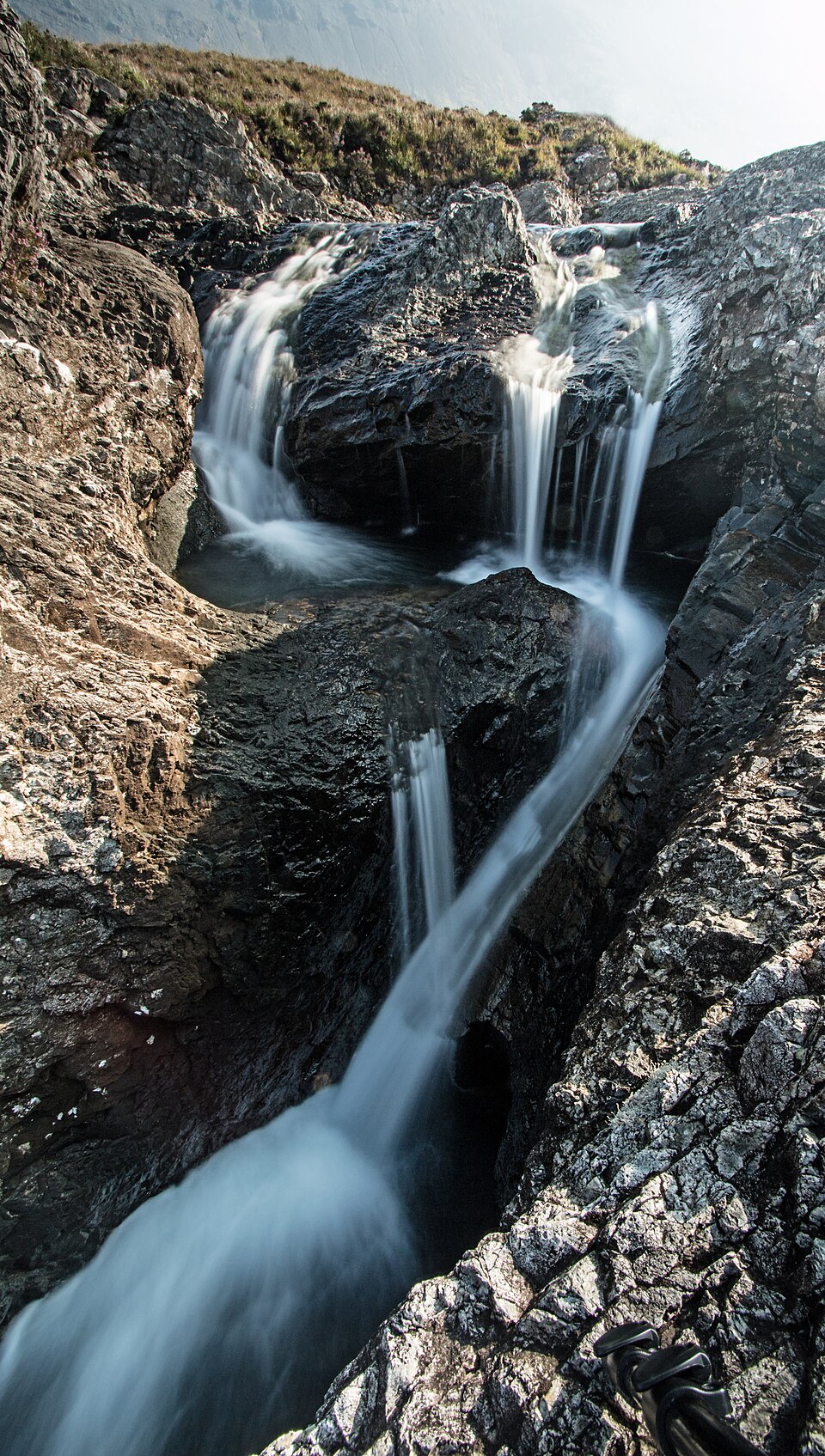
The Fairy Pools are a series of crystal-clear pools and waterfalls in the Black Cuillin Mountains on the Isle of Skye that look exactly as described: the sort of place where a fantasy film would shoot the scene where the protagonist discovers magic. The water is an improbable turquoise-blue. The surroundings are dramatic highland terrain. It rains with some regularity, which is the detail the photographs leave out and the reality immediately supplies.
The pools are fed by the River Brittle running from the Cuillin ridge, the clarity coming from peat-filtered water running over basalt and sandstone. They are accessible on foot from a car park near Carbost, which is the kind of information that feels faintly absurd to record given what you're walking to. The swim is cold - consistently, aggressively, immediately cold, as the water arrives directly from a mountain range. Visitors swim in them regardless with impressive consistency, which says something about either human optimism or what good lighting does to a body of water.
From Edinburgh, the Fairy Pools are roughly a five-hour drive northwest, passing through scenery that is at several points also showing off. The pools have acquired increasing attention over the past decade, which means arriving early is worth the effort - the car park fills, the path gets busy, and the quiet highland morning atmosphere is the part of the experience that the photographs can't quite capture.
Waitomo Glowworm Caves, New Zealand
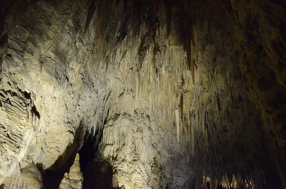
The Waitomo cave system in New Zealand's Waikato region contains an active population of Arachnocampa luminosa - a species of fungus gnat whose larval stage produces bioluminescent light to attract prey. When several hundred thousand of them are suspended from a cave ceiling simultaneously, the effect is a replica of a night sky underground: a constellation of blue-white points of light that exist only because the organism in question has evolved a particularly efficient hunting strategy.
The glowworms eat by hanging sticky threads from the cave ceiling and producing light to attract flying insects. Small flies navigate toward the glow and become tangled. The cave contains, essentially, a functional trap operating at the scale of a cathedral, which is the detail that improves the more you think about it. The tour boats pass beneath this in silence - silence is important, as glowworms dim their lights in response to noise - which has turned out to be a remarkably effective way to regulate visitor behavior in the 140-odd years since the cave opened to tourists.
Maori chief Tane Tinorau and his wife guided the first European visitors through the system by candlelight in 1887. The guided boat tour through the illuminated cave now runs several times daily from the township of Waitomo, which is roughly two and a half hours south of Auckland. The experience sits somewhere between the genuinely sublime and the sort of thing described in fantasy novels, and the combination of geological age (thirty million years of cave formation) with biological ingenuity makes Waitomo one of those rare places that is better than the photographs.
Salar de Uyuni, Bolivia
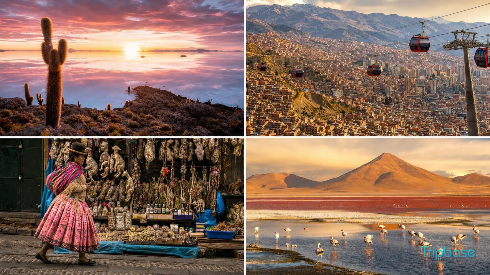
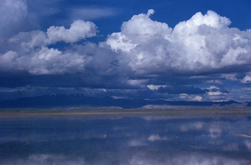
The Salar de Uyuni in southwestern Bolivia is the world's largest salt flat at approximately 10,582 square kilometers - an area roughly the size of Jamaica. In the dry season, it reflects light as a white geometric expanse that extends to every horizon. In the wet season, a thin layer of water transforms the surface into the world's largest natural mirror, producing a reflection of the sky so precise that the horizon disappears and the effect is of standing inside a perfectly symmetrical chamber of cloud and light.
The salt crust - between two and twelve meters thick depending on location - sits above a brine lake containing an estimated 70% of the world's known lithium reserves. This means the surface that looks like the cover of an ambient music album contains, directly below it, one of the most economically significant mineral deposits on the planet. The Salar manages to be simultaneously a natural wonder and a geopolitical resource, which is a combination that would feel heavy-handed in fiction but is simply what Bolivia has.
La Paz is the conventional starting point for Uyuni visits, with the salt flat sitting at 3,656 meters above sea level - high enough to require acclimatization planning. Tours from Uyuni town also access the connected Eduardo Avaroa Andean Fauna National Reserve, which contains geysers, colored volcanic lakes, and flamingos, because the southwestern corner of Bolivia apparently decided that a single remarkable natural feature was insufficient. The wet season reflection effect runs roughly December through April, depending on rainfall; the dry season's white expanse has its own logic. Either is worth the altitude.
What unites this list is that all of these places took somewhere between ten thousand and twenty-four million years to produce, which puts a certain perspective on the two-week package holiday. Worth checking, though, before you book: the Door to Hell requires a Turkmenistani visa and an organized tour; Fly Geyser is accessible only through the Burning Man organization's booking system; and the Fairy Pools car park charges for parking. Reality, for all its ambition, still has admin. It also has our guide to extreme travel records, which covers several of these regions in further detail.