The World's Most Absurd International Borders
Political borders were not designed to be logical. They were designed to be final - ideally defensible, occasionally fair, and, in the fullness of time, mostly forgotten by everyone except the people who have to live with them.
What geographers call "enclaves" and "exclaves" are what the rest of us might call "the consequences of exhausted diplomats drawing lines on maps at three in the morning and then going home." The results include towns where your living room is legally in two countries, railways that accidentally created foreign nations by existing, and at least one public library that has operated across an international frontier for over a century without anyone formally resolving the situation. These are not historical anomalies in the process of being corrected. They are current, ongoing, legally enforced facts, and they are magnificent.
Baarle-Hertog: The Town That Rejected the Concept of Geography
The Belgian municipality of Baarle-Hertog exists as twenty-six separate enclaves inside the Netherlands. The Dutch municipality of Baarle-Nassau wraps around and between those enclaves. The borders were formalized by the Treaty of Maastricht in 1843, which attempted to ratify medieval property transfers dating back to the twelfth century, when the Duke of Breda granted various parcels of land to various lords in a manner that seemed, at the time, entirely straightforward and has produced, in the centuries since, a municipal boundary that looks like a cartographer having a very specific kind of breakdown.
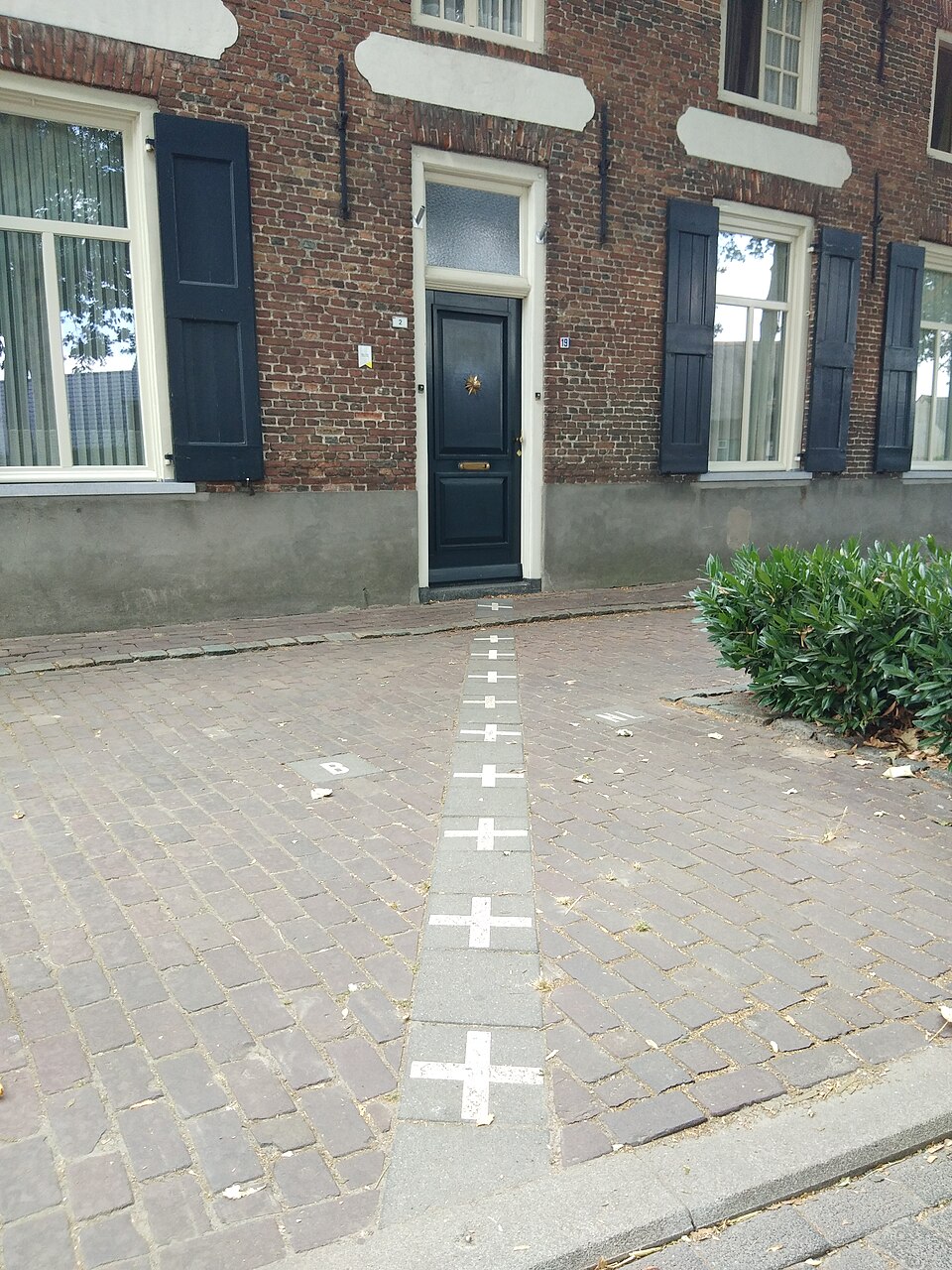
Some buildings in the town sit directly across the Belgian-Dutch border. For these buildings, nationality is determined by the location of the front door: a restaurant whose door is in Belgium is a Belgian restaurant, subject to Belgian tax rates, Belgian licensing laws, and Belgian closing times. The kitchen, which might be in the Netherlands, operates under Dutch regulations. This has led to the pragmatic local tradition of occasionally moving front doors when the regulatory environment in one country becomes more favorable, which is a form of international tax optimization that has not yet been codified in either country's tax code and therefore continues undisturbed.
The borders are marked on pavements and roads with white crosses, so residents know, moment to moment, which country they are in. A person getting a morning coffee might cross the Netherlands-Belgium border four times between their house and the cafe, depending on the route. Residents describe this as normal, which it is, for them. The town is a straightforward trip from Amsterdam and draws a substantial number of visitors who come specifically to stand in two countries at once and photograph the pavement markings, which is perhaps the most sustainable tourism model available to a municipality primarily famous for existing in multiple countries simultaneously.
The Vennbahn: How a Railway Accidentally Created Countries
The Vennbahn is a 125-kilometer former railway line in western Europe that, by the terms of the post-World War One peace settlements, was transferred to Belgian sovereignty. Railways change hands; this is not unusual. What the cartographers did not sufficiently notice was that the Vennbahn's route, in several places, passed through German territory in a way that - once the railway became Belgian - left small communities of German residents as exclaves: pieces of Germany, physically surrounded by Belgian territory, with no land connection to Germany.
The exclaves that resulted include Rödchen and Mützenich, small enough communities that the geopolitical literature of the twentieth century largely managed to overlook them entirely. They are, by any objective measure, charming anomalies - places where the post-WWI settlement, specifically designed to settle things, produced a situation that required additional settling. Today the Vennbahn line has been converted into a cycling trail, which means you can cycle through Belgium and periodically pass through Germany without anyone in the arrangement registering this as anything but a pleasant afternoon.
The trail runs through the Eifel and Ardennes near Luxembourg, in a corner of Europe where countries are compact enough that you can drive through three of them before lunch without especially trying. The existence of several additional micro-exclaves fits naturally into the general texture of a region where "international border" has always been more of a guideline than a hard line.
Kaliningrad: Russia's Orphaned Outpost
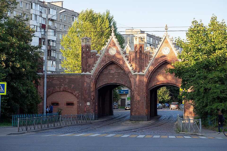
Kaliningrad is a Russian city of roughly 450,000 people on the Baltic coast - a port, a naval base, and, since the Cold War ended and the countries around it joined opposing alliances, an exclave with no land border with the rest of Russia. It is surrounded by Poland to the south and Lithuania to the north and east, both of which have been EU and NATO members since 2004. To travel between Kaliningrad and Russian mainland territory overland requires crossing at least one European Union country, which has become an increasingly complicated exercise since 2022.
The oblast became Russian after World War Two as specifically retained Soviet territory - a warm-water Baltic port that Stalin insisted on keeping during the Potsdam negotiations, which resettled the German population and renamed what had been Königsberg. This is not historically unusual as conquest goes. What is less usual is that the Soviet Union subsequently dissolved, the countries between Kaliningrad and Russia became liberal democracies and then NATO members, and Russia found itself with a strategic outpost accessible only by sea or by negotiating transit rights through countries whose relationship with Russia has undergone considerable revision.
Transit rights through Lithuania - via the Suwałki Corridor, a roughly 65-kilometer stretch of territory between Poland and Vilnius - exist but have become politically sensitive in ways that generate both NATO contingency planning and academic papers at roughly the same rate. Kaliningrad is also, incidentally, a genuinely interesting city to visit: the Amber Museum is world-class, Königsberg Cathedral is a striking ruin, and Immanuel Kant spent his entire philosophical career there without ever leaving, which is either a statement about the city's intellectual richness or its historical distance from anywhere else.
Point Roberts, Washington: America's Least Accessible Corner
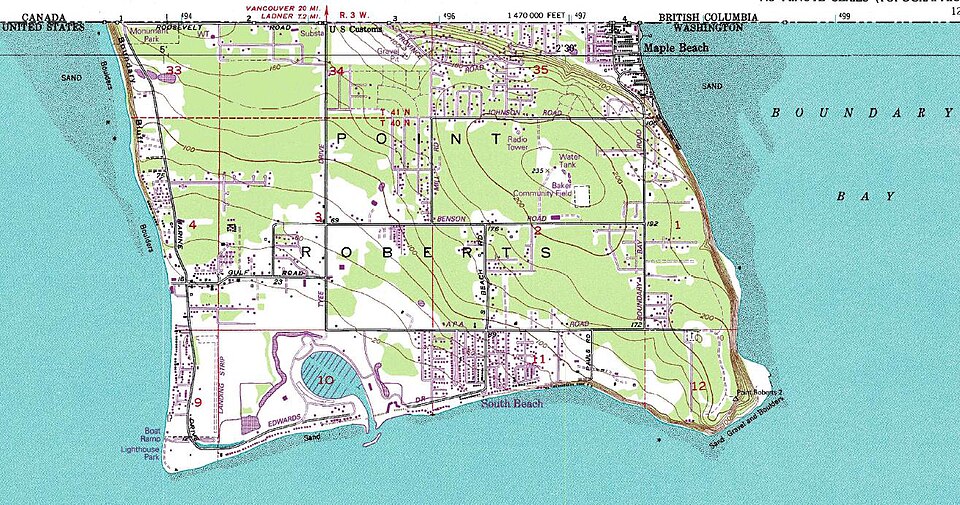
Point Roberts is a community in Washington State with around 1,300 permanent residents, a marina, and the distinction of being part of the United States while being accessible by land only through Canada. The 49th parallel, which forms the US-Canada border across the continent, passes through the base of the Point Roberts peninsula, leaving its southern tip - about five square kilometers of it - on the American side with no land connection to the American mainland. To drive from Point Roberts to the nearest American city, Bellingham, requires approximately 40 minutes of driving through British Columbia, a Canadian border crossing, and then an American border crossing back into Washington State.
This situation has existed since 1846, when the Oregon Treaty established the 49th parallel as the border and someone in the diplomatic process did not look carefully enough at the peninsula. For most of the community's history, the situation was a mild inconvenience with some useful side effects: Point Roberts had a favorable environment for certain goods, and a substantial number of Canadians maintained mailboxes there to receive US-rate shipping. The informal economy of the border has always been creative.
Post-9/11 border tightening created real hardship: residents now need passports for what is, functionally, domestic travel. Point Roberts children attending school in Blaine, Washington are bused through Canada daily, which means a school run involves two international border crossings each way. During the COVID-19 pandemic, when both countries imposed strict border restrictions, Point Roberts was simultaneously cut off from Canadian services it depended on and American mainland services it was geographically disconnected from. It was, briefly, a place that existed outside the practical reach of both countries' normal functioning, which is an experience that the 1846 treaty negotiators did not appear to have modelled.
Campione d'Italia: Italy's Swiss Interior
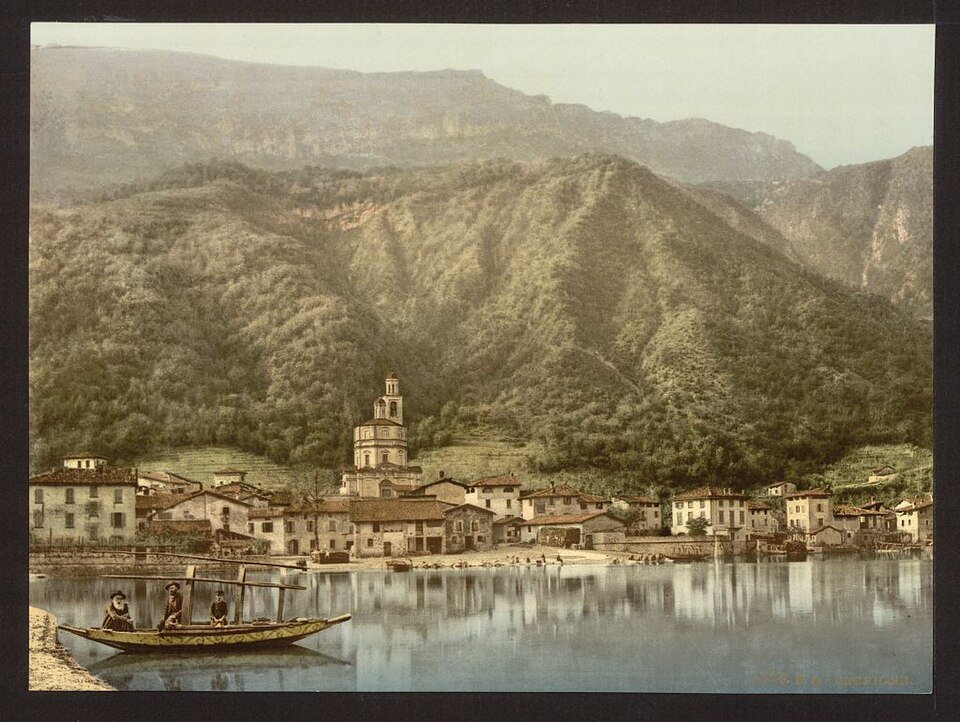
Campione d'Italia is an Italian municipality on the shores of Lake Lugano that has been an exclave of Italy since 1798, surrounded on all land sides by Switzerland. Italian law applies. Italian citizens live there. It returns members to the Italian parliament. It is, by every legal measure, Italy. It uses the euro (having switched from the Swiss franc in 2003 - creating the pleasant situation of an Italian town adopting a currency that Switzerland itself has always declined to adopt). It dials Swiss phone numbers. It is accessible primarily by driving through Switzerland. Swiss customs handles its border formalities. It is Italy, thoroughly, while being located inside Switzerland in a way that is not metaphorical.
The situation arose because of the region's complicated medieval property history, which eventually left this particular piece of land belonging to Milan rather than the Swiss Confederation, and it has remained Italian through every subsequent reorganization of European territory, despite being considerably closer to Lugano than to any Italian city of consequence. The Casino di Campione, which operated for decades as one of Europe's largest, was a direct product of this jurisdictional peculiarity: the casino existed in a legal and tax environment created by the overlap of Italian and Swiss regulation that was genuinely unique. It closed in 2018, restructured, and reopened, which is the standard trajectory for casinos and perhaps speaks to the limits of exclave-based business models as a long-term strategy.
Arriving in Campione is genuinely surreal: you drive through Switzerland, the road signs change to Italian, the menu at the lakeside cafe is Italian, and everyone around you is completely accustomed to having done exactly this for their entire lives. It is Italy. It is inside Switzerland. These two facts coexist peacefully and have for over two centuries.
The Haskell Free Library: Books on the Fault Line
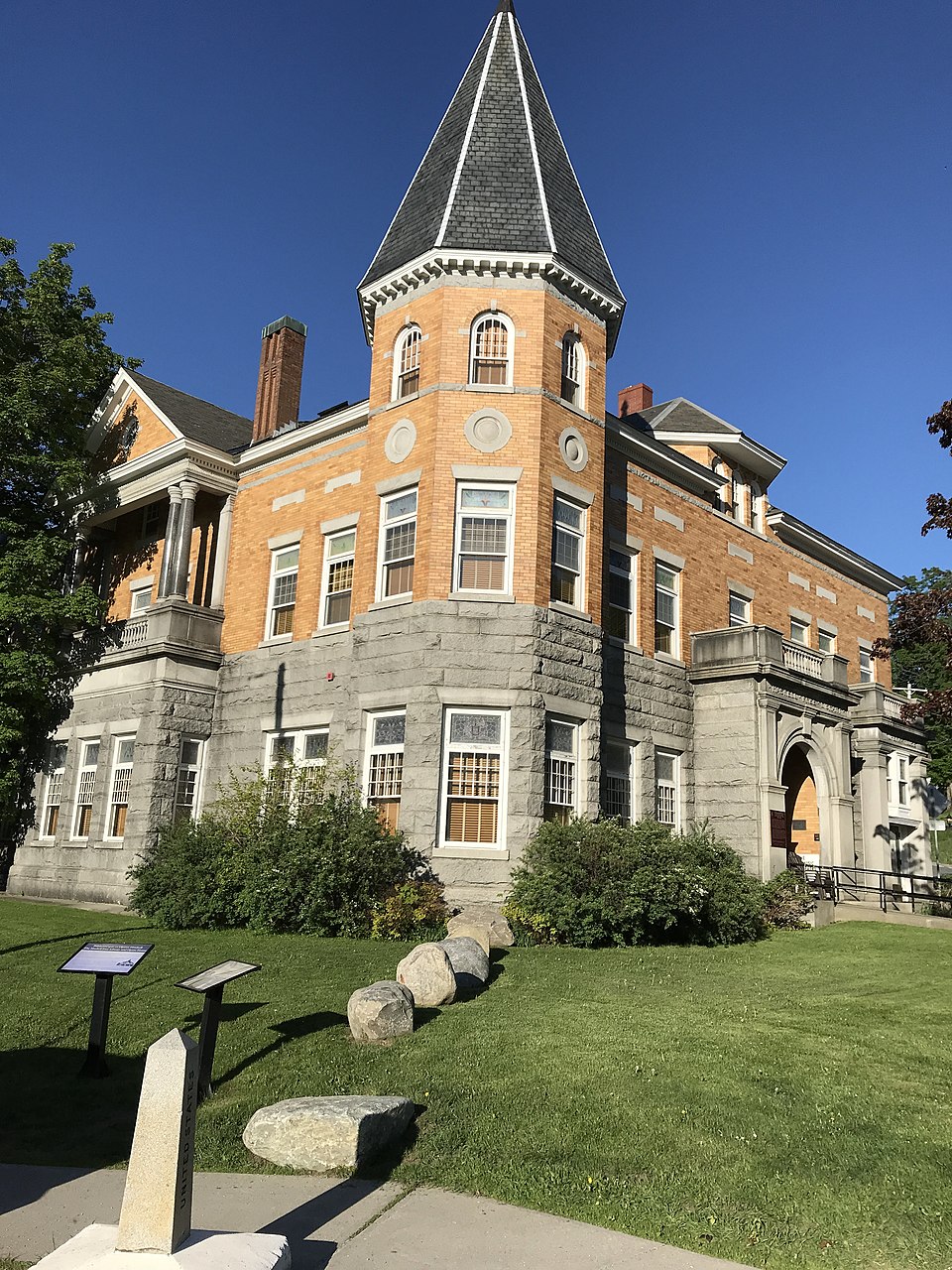
The Haskell Free Library and Opera House in Derby Line, Vermont and Stanstead, Quebec was deliberately constructed straddling the US-Canadian border in 1901 by the Haskell family, who wished to give the gift of culture to both nations simultaneously. This is a generous impulse. The building's reading room is in Canada. The books are in the United States. The main circulation desk, where one checks out those books, sits on the international boundary line, marked on the floor by a black stripe, and to cross which - technically - constitutes entering another country without a formal border crossing.
For most of the library's operation, this was charming and only mildly complicated. After 9/11, it became briefly unclear whether using the library constituted an unauthorized border crossing requiring documentation, which would have made checking out a paperback novel a federal matter. The resolution was an informal bilateral arrangement maintained by US Customs and Border Protection, the Canadian Border Services Agency, and the library itself: using the library is not considered a border crossing for enforcement purposes, provided you enter and exit on your own country's side of the building and do not wander into the other country's town.
This arrangement has no formal legal basis. It is an understanding between border agencies and a public library that has been honored continuously since 2001, because the alternative - installing passport control between the biography section and the audiobooks - is the kind of solution that would resolve the technical problem while creating a different, more visible kind of absurdity. The library is the more civilized option. It has remained the more civilized option for over two decades, which is, in the context of everything else on this list, something of a triumph.
For the broader canon of humans creating regulations that solve problems by producing different problems, see our article on the world's most bizarre laws. And if the theme of places existing at the edges of conventional geography has your attention, our guide to the world's most remote places covers a different variety of the same human capacity for inhabiting the improbable.
Have you visited any of these border anomalies? Stood in two countries simultaneously on the pavement crosses of Baarle-Hertog, crossed into Point Roberts on a school run, or checked out a library book from the Canadian side of an American collection? These are places where the world's most elaborate bureaucratic systems meet their most improbable geographical exceptions - and the gaps between them are often exactly where the most interesting travel happens.