
Alaska Highway Grand Tour
The classic point-to-point drive of the whole Alaska Highway - from its Mile 0 in Dawson Creek, British Columbia, north through Fort Nelson and Watson Lake into the Yukon (Whitehorse), across the remote US - Canada border and on to Delta Junction and Fairbanks, Alaska. A summer-only self-drive of long, empty legs, big wildlife and one genuine wilderness border crossing.
7–14 days · Point-to-point
When to go
- WeatherSummer-only highway (Oct - May) — This is a June-to-mid-September drive - most lodges, fuel stops, tours and visitor services along the highway close for winter, and snow, ice and thin daylight make the remote legs genuinely hazardous outside summer
- VisaUS - Canada border crossing — carry a valid passport - the highway crosses the international border at Port Alcan / Beaver Creek, one of North America's remotest posts with limited seasonal hours; US visa-waiver / ESTA (or a visa) applies to non-North-Americans entering Alaska
- WeatherFrost heaves, gravel breaks & long daylight (Jun - Aug) — near-24h daylight eases the driving but pavement is lumpy with frost heaves and occasional gravel construction breaks; carry a spare tire and expect no cell coverage for hours at a stretch
The Alaska Highway is one of the great drives on earth - 1,400-odd miles of two-lane road punched through the sub-Arctic wilderness by the US Army in 1942, running from its Mile 0 in Dawson Creek, British Columbia, up through the Northern Rockies and the Yukon and across a genuine international border into Alaska. This is the classic point-to-point version: Dawson Creek to Fairbanks, a linear self-drive rather than a loop. It's a road trip first and a sightseeing list a distant second - the distances are enormous, the towns are far apart, and the empty, wildlife-strewn country between stops is half the reason to come. Plan around fuel, daylight and the short June-to-September season, not around a packed itinerary.
This route's vibe
What you get across the whole trip, blended from each stop's strengths.
Stop by stop
The route
Adjust trip length, budget, and travel style — the stops, transport, and cost update to match.
- 1
Dawson Creek
1 nightMile 0 of the Alaska Highway: photograph the cairn and the Mile 0 post, provision at the last big-box supplies before the north, and set the trip odometer here. A functional prairie town whose whole identity is being the start line.
Full guide coming soon for this stop.
Getting there· ~369 kmCarRecommendedThe standard opening leg, ~5h north on the Alaska Highway (BC-97) through rolling farmland and boreal forest - paved and easy, but the last stretch where towns come regularly, so enjoy the services while they last.
Book: rental desk (Dawson Creek / or start from Whitehorse or Fairbanks) — if you rent in Alaska for a one-way drive, book a vehicle explicitly cleared to cross into Canada and back - many Alaska/BC rentals restrict or surcharge cross-border and one-way drop-offs
- 2
Fort Nelson
1 nightThe last sizeable town in northern BC and the natural overnight before the highway climbs into the Northern Rockies. Beyond here services thin dramatically, so top up fuel, food and the tank of patience.
Full guide coming soon for this stop.
Getting there· ~367 kmCarRecommendedThe most scenic BC leg, ~5-6h climbing through the Northern Rockies past Muncho Lake and Liard River Hot Springs - wildlife on the road (bison, stone sheep, black bears) is common, so drive it slowly and in daylight.
Book: self-drive — fuel stations are sparse and cash-only or closed off-season - never leave Fort Nelson below three-quarters of a tank, and don't count on the pump at every dot on the map
- 3
Watson Lake
1 nightGateway to the Yukon and home of the Sign Post Forest - tens of thousands of signs nailed up by passing travelers since 1942. The scenic Muncho Lake / Liard River Hot Springs stretch just south of here is the wildlife highlight of the BC leg (bison, stone sheep, bears on the road).
Full guide coming soon for this stop.
Getting there· ~356 kmCarRecommendedA ~5h run into and across the southern Yukon on well-graded highway - long, empty and beautiful, with Teslin and the big-lake country en route to the territorial capital.
Book: self-drive — cell coverage effectively vanishes between towns on this leg - download offline maps and tell someone your plan before you set off
- 4
Whitehorse
2 nightsThe Yukon's capital and the biggest town on the whole drive - a real rest stop with the SS Klondike sternwheeler, the Yukon River, Gold Rush history, restaurants and outfitters. Use the extra night to service the car and stock up before the push to the border.
Full guide coming soon for this stop.
Getting there· ~133 kmCarRecommendedAn easy ~2h west on the Alaska Highway to Haines Junction, the gateway village at Kluane's edge - the shortest, gentlest leg of the trip and a good half-day so you arrive with time for a flightseeing tour.
Book: self-drive
- 5
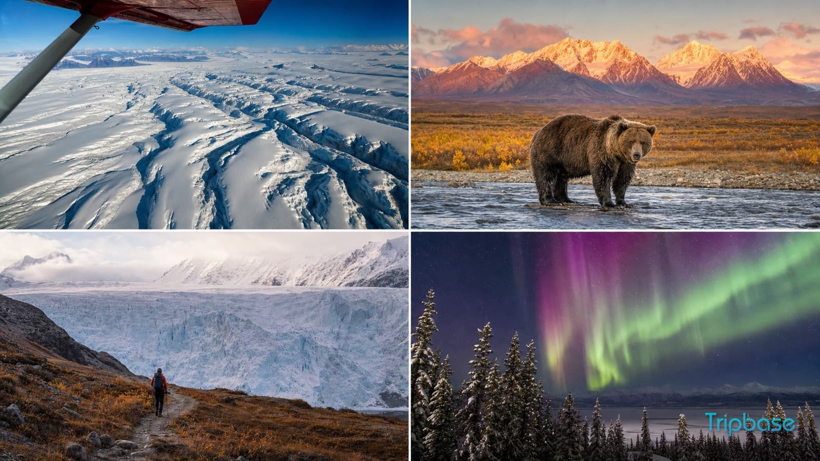
Kluane National Park
1 nightCanada's roof, reached from the highway village of Haines Junction - the country's highest peaks and largest non-polar icefields, best grasped on a flightseeing trip since you can't drive into them. The scenic climax on the Canadian side before the border run.
Skip / overrated: Don't plan a big overland hike into the icefields on a one-night stop - you can't drive in and the classic treks are multi-day; put the money into a flightseeing tour instead, the only way to see the scale.
View Kluane National Park guide→Getting there· ~559 kmBorder crossingCarRecommendedThe big border-crossing day, ~8-9h with stops - northwest through Burwash and Beaver Creek to the remote US - Canada line at Port Alcan, then across Alaska to Tok and on to Delta Junction. This stretch has the trip's worst frost heaves and longest fuel gaps.
Book: self-drive — have passports ready and cross in daylight - Beaver Creek / Port Alcan is one of North America's remotest posts with limited seasonal hours; and the Beaver-Creek-to-border section is the single longest fuel gap on the highway, so fill up in Beaver Creek
- 6
Delta Junction
1 nightThe official END of the Alaska Highway - Historic Milepost 1422, where it meets the Richardson Highway. A low-key farming town, but the ceremonial finish line; overnight here to break the long border-crossing leg before the short run to Fairbanks.
Full guide coming soon for this stop.
Getting there· ~130 kmCarRecommendedThe short victory-lap finish, ~1.5-2h northwest on the Richardson Highway from the highway's official end at Delta Junction into Fairbanks - smooth, quick and well-served after days of wilderness.
Book: rental drop-off (Fairbanks airport)
- 7
Fairbanks
2 nightsThe big Interior Alaska city and the trip's real terminus - hot springs at Chena, the Museum of the North, midnight-sun baseball in June, and the practical place to drop the rental and fly home. Most travelers finish the highway here rather than at the technical endpoint in Delta Junction.
Full guide coming soon for this stop.
Lodging + daily spend only — excludes flights & intercity transport. Partial: some stops lack cost data.
What to skip
Don't try to bolt on Alaska's Southeast (Juneau, the Inside Passage) - it's a ferry-and-cruise world with no road link to this highway and turns a clean drive into a logistics puzzle. And skip the temptation to do the whole thing in under a week if you value your back; the frost heaves and distances punish a rushed schedule.
Practical tips
Rent a vehicle explicitly cleared to cross the US - Canada border and to be dropped one-way at the far end, carry passports (ESTA/visa for non-North-Americans entering Alaska), never let the tank drop below half on the remote legs - especially Beaver Creek to the border - carry a spare tire for the gravel breaks, and book Kluane flightseeing and any lodge nights well ahead, since summer capacity up here is thin.
Best for
Common questions
How long does the Alaska Highway drive take?
Seven to nine days is the sweet spot for Dawson Creek to Fairbanks - enough to cover the daily distances without marathon driving days and to give Whitehorse, Kluane and Fairbanks real time. You can push it in a week, or stretch it to two by adding Dawson City and slower legs.
Do I need a passport for the Alaska Highway?
Yes. The route crosses the US - Canada border at Port Alcan / Beaver Creek on the way into Alaska, so carry a valid passport; non-North-Americans need ESTA (visa waiver) or a visa to enter the US. Check the remote crossing's seasonal hours and cross in daylight.
When is the highway open?
The road itself is open year-round, but this is realistically a June-to-mid-September trip - most lodges, fuel stops, tours and visitor services along the way close for winter, and snow, ice and short daylight make the remote legs hazardous outside summer.